Post Kala Patthar, after a hearty breakfast, we began our rapid fire descent, flying down from Gorak Shep, past the memorials for Everest climbers who perished, in time for lunch at Thukla around noon. We said goodbye to Andrew as he ventured off to tackle Island Peak, and geared up for a very snowy walk down to Pheriche.
::goodbye big beautiful mountains::
::down down down::
::memorials::
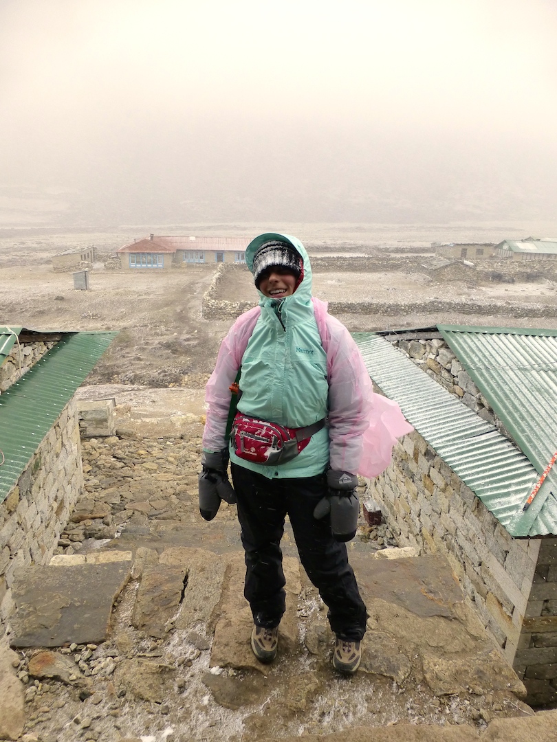
I never said I’d be the most attractive hiker on the mountain, but I hadn’t quite realized my cold, snowstorm outfit would be this sexy:
::be prepared to look this sexy::
Pheriche, where we slept on our first night descending, was a surprisingly large town. I think a number of trekkers on the traditional EBC route stop here on the ascent. We were delighted to find that this tea house turned the stove on early in the afternoon and in the morning. Talk about living large!
::entering Pheriche::
The next day was a full day of “downhill.” In reality, I think we may have actually ascended more on this day than we ever did on a day of actual “uphill” climbing! I might be exaggerating, and my mind might have mentally checked out of trekking once we hit the “big four.” But, man, was it hard to motivate this day. I kidded with Rishi often, “so when do we get the helicopter?” Little did I know, it pays to be whiny! 😉
::great views of the river::
::getting our final bits of good luck spinning the Tibetan prayer wheels::
This day of descending brought us through much of the EBC trail, nearly all of which we hadn’t seen yet since we turned towards Gokyo slightly after Namche Bazaar. We passed a valley where we could see the path to Dingboche and Chukhung. After a while we came to the little village of Pangboche that had nice views of Ama Dablam, Lhotse, and Nuptse.
::mani and porter::
Later we saw the turn off to head right for Phortse, but we continued left all the way down to the river, crossing it before another steep uphill. The river was beautiful and flowing vigorously. Finally we were in Tengboche, a lovely little town where we had an absolutely fantastic lunch at Tashi Delek. I had to wait almost an hour for a pizza since they turned on the special pizza oven for me, but it was definitely worth the wait and probably the best meal I had in the Himalayas. Also, they had a western toilet (with a flush!!!), which was impossibly exciting after days of deprivation. By now it was much warmer (and greener! We’d made it back down past the tree-line) and we shed layers (I removed the second and third pant layers for the first time in over a week) and ate outside with a spectacular view of Everest, Ama Dablam, Lhotse and Nuptse, as well as the beautiful monastery here. To say we were pleased would be an understatement.
::monastery::
::shedding clothes!!::
::stunning vista::
::impressive views, no?::
::river::
After lunch we briefly explored the monastery before continuing down (and up and down and up and down).
::inside the monastery::
::inside the monastery::
We passed a field of yaks being loaded up for hauling expedition gear to the top. And we also saw loads of sherpas carrying NBC Discovery gear for coverage of the BASE jumper (good luck to him, that sounds like a terrible decision…). [NB: The jump was canceled due to the avalanche.]
::yaks geared up for base camp::
It was only about six hours of actual walking, but this day felt much harder than many of the others (even despite the fact that the oxygen levels felt indulgent to us at this point). I always find the downhill a bit of a struggle, between the impact on the knees and the inevitable blisters (by the end of the day I had band-aids on seven of ten toes), and the whole already being “done” mentally thing. Over the past two days we descended 7,000 feet, not to mention the ups and downs, which would make it probably closer to a figure around 9,000. That’s a lot of hills. (Also, the second day of descent was very dusty.)
We stayed at the same tea house in Namche Bazaar (in the very same room!) as we did on the way up. This time again we showered, and it was either much warmer or the higher altitudes gave us thicker skin because it was the most glorious shower of all times and I didn’t even complain about waiting for my hair to dry in the cold.
::to Namche!::
::reentering the land of plants – lots of rhododendron here::
::frozen waterfalls in the distance::
::Tibetan prayer wheels::
We had a celebratory dinner of meat! And apple pie! Eventually Jenni moseyed on up to bed, and while Alan was hanging out in the common room, Rishi wandered up to Alan and began a conversation with, “so, if you were serious about the helicopter thing…”
It was hard to believe. Very hard to believe. But Rishi informed us that another Himalayan Glacier client had hired a helicopter for the next morning because she was ill. Her guide was unable to go down with her since he was still taking the rest of his group up to Island Peak. Since she had the extra room in her chopper, and Rishi would be able to make sure she arrived safely at the clinic down in Kathmandu, we basically got to freeload rides in her rescue chopper. We were skeptical up until the last minute. Even walking up to the heli-pad. Even sitting there waiting with a sick woman who’d painfully made her way up there. But then there it was.
::it arrives!::
Sweet, glorious, helicopter in the Himalayas. Was that not one of the coolest things I’ve ever done! Alan had already been in a chopper, but this was Jenni’s first time. It took a lot of self restraint not to gush about how excited I was (out of respect for the poor girl sitting next to me), but knowing she was there also helped me to not freak out about the whole heights thing. I knew I couldn’t make it about me, when this lady was sitting in her generously shared rescue ‘copter fighting for air.
::hovering over Namche::
::this is awesome::
::I’m sorry but, how cool is this shot!?!?::
::heli selfie::
After a refueling stop in Lukla, we arrived in the Kathmandu airport and (no joke) took the ambulance with this poor sick woman all the way to the clinic (talk about overstaying your welcome and feeling a little awko taco). We grabbed a car back to Hotel Shanker and that night we celebrated our farewell dinner with the EBC trekkers from the other Himalayan Glacier group. Somehow, even with the loss of a day on the front-end, we finished our trek early! So our 14 day trek ended up being a jam-packed and adventure filled 12 day trek, but we wouldn’t change a thing. (Well, except maybe the headaches and nausea).
::coming back into Kathmandu::
::coming back into Kathmandu::
::coming back into Kathmandu::
Practical Info
Accommodation: In Pheriche we stayed at Pumori Lodge. There are several accommodation options in this village, and others we saw offered WiFi. But the welcome was warm at our tea house, both literally (as noted, the stove was fired much of the time) and figuratively. In Namche, we stayed again at the Nest (in room 211), which we already covered in our previous post.
Food and Drinks: We had lunch in Thukla the first day of our descent…meh. The food at Pumori Lodge in Pheriche was fairly good. Lunch at Tashi Delek in Tengboche was great, both the food and the view from the large deck. It was glorious to enjoy milk in my coffee and soft butter at breakfast back in Namche Bazaar after a week plus of avoiding meat and dairy.
Activities: It was nice to see the monastery in Tengboche. There is no entrance fee but a small donation is recommended.
An hour or two after leaving Dzongla for Lobuche, we rejoined the main Everest Base Camp (“EBC”) trail and it felt like coming back to civilization, seeing so many more people. We even bumped into the other half of the Himalayan Glacier trekkers, on their way down after summiting Kala Patthar. We bonded in our Lobuche tea house over altitude sickness, cold, and general lack of creature comforts. They continued on to more oxygen-rich environments and we spent the afternoon playing many rounds of dhumbal and chatting with our new friends Mike and Sandra from the Bay Area. It was here that we began seeing lots of Everest climbers, and I have to admit, this environment is really inspiring. Andrew recognized an IMG guide from a documentary he’d seen as the guy who helped break up the infamous 2013 EBC brawl between sherpas and foreign climbers.
::hanging with the big kids::
The next morning we trekked to Gorak Shep (our “final” destination) where we ate lunch at our tea house before setting out for EBC.
::on the walk to Gorak Shep::
::Rishi::
::yak jam::
This was perhaps one of my favorite moments of the whole trek. This big group of yaks came through, and they were all wearing bells and decorated with yak earrings and colorful sweaters. It just felt magical. Like a herd of Christmas yaks were coming back from the North Pole. Sigh. I love yaks. Andrew smartly pointed out that I’m probably a bigger fan of the animals than I am of the mountains. I can’t deny it.
::very excited::
::magical North Pole yaks::
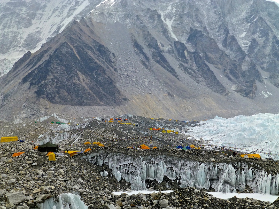
Eventually we began seeing EBC and the Khumbu Glacier and Khumbu Icefall. (Just a few days after we left there was an avalanche there resulting in the deadliest day ever on the mountain. Terribly sad and even more personally impactful knowing we likely passed some of the stricken sherpas on our walk. Our hearts go out to them and their families.)
::Everest base camp and Khumbu icefall::
The walk to EBC took less than two hours, and while it was a bit of up and down, we didn’t find it too challenging (fortunately we all avoided some rock falls). I think by this point we were much better acclimatized and everything felt easier, even though we were above 17,000 feet. We enjoyed huge views of Nuptse on our right, Lingtren (conjuring extreme skiing images for Alan) and Pumo Ri. By the way, this area is very close to Tibet. We asked Rishi about a mountain we saw barely beyond the others, and he said “oh, that’s not ours.”
A lot of people say EBC is not terribly exciting; “it’s just tents.” But they are the tents of people gearing up to climb the tallest mountain in the world! Unless you know climbers or guides in the actual EBC tents, you will only view base camp from a short distance rather than really getting in the midst of it. So while we didn’t cover the entire area, based on what we saw we’d say the rumors of lots of trash are false. In fact, we saw several porters carrying down jugs of human waste and bags full of garbage, and thought this area was relatively free of litter (sadly, this was not the case for other parts of the trail, especially a small area near the village of Gokyo). We found it very exciting to be at EBC. Or perhaps it’s just that it was the first “big” destination we hit where I didn’t feel like dying from the altitude. Either way, it was a special moment.
::Everest base camp!!::
::Khumbu ice fall::
::Everest base camp!!::
::Everest base camp!::
::the whole crew::
We even got to witness Tibetan monks singing and dancing in prayer for a safe journey for the climbers.
::Tibetan dancing::
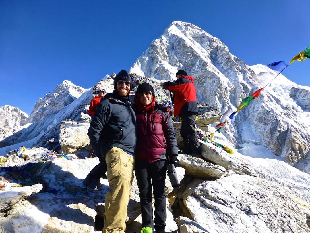
After getting a few pictures in, the weather turned drastically, and I could barely get enough layers on to keep from getting snowy and cold. True story, Alan had to pull up my rain pants. We did manage to get in this picture for Alan’s mom, whose birthday it happened to be when we made it EBC!
For the final big push of the trek we woke early to summit Kala Patthar. I was on the fence about even attempting it given how I’d fared on Cho La Pass, but having felt so strong at EBC I gave it a go. We all felt surprisingly good going up. We lucked out with great weather again, and a slow steady climb with multiple stops for water (since the Camel-Bak kept freezing), brought us to the summit around 7:15. The last stretch is a bit of a beast because you traverse some large rocks that were covered with a fresh coating of snow. At times I could swear the summit was getting farther away. It’s a little bit shorter distance than the hike up Gokyo Ri, which also helped it feel easier for us. But the altitude was our highest of the trip at 18,200 feet!
::going up::
::and up and up::
::summit!::
::the beginning of the KP trail::
::Everest::
::18,200 feet, baby!!::
We watched the the sun rising behind Everest, and from the summit we savored phenomenal views of the other big ones like Lhotse, Nupste, Lingtren and Pumo Ri towering directly above us.
::good morning Everest::
::Everest::
::view of EBC from the climb up KP::
::down down down::
::heading down::
Back at the tea house we secured our place in history by decorating a shirt and hanging it on the ceiling. It’s possible this brought me more pleasure than actually climbing those peaks ;). Go team Cali! We wound up using the t-shirt Himalayan Glacier gave us, but those coming from home who wish to do something like this might consider bringing a flag and/or photographs to affix. (P.S. I was impressed how well represented Turkey was in these tea houses! I think we saw at least one Turkish flag on every wall!)
::proof::
Practical Info
We began our Kala Patthar hike at 5:30 am and summited at 7:15 am. Some start at 4 am to really see the sunrise from the top. I would consider starting more like 7 am. You want an early start to ensure the weather doesn’t turn bad, but if you start later than we did then I think you would enjoy better lighting for pictures. While we were at the top, Everest was so back-lit that it was hard to get good photos.
Accommodation: We stayed at Lobuche Eco Resort. It costs 350/hour to charge batteries and WiFi was an exorbitant 1000/hour. The common area was loaded with real mountaineers and we enjoyed the energy and excitement in the (thin) air. In Gorak Shep we stayed at Yeti Resort. We do not know if the alternatives are better, but we did not particularly like this place. It smelled bad, the toilet was on an incline which was treacherous when icy, and the construction was unusually shoddy leading to a door-lock-opening injury and walls that didn’t fully connect so you could sort of see your neighbor vs. the usual simply hearing her.
We woke at 4:40 for an early breakfast and start for the hardest day of the trek. By the time we got out the door it was 5:50 and there was no need for a headlamp, but the sun was blocked by the large mountains ahead (we were going east) and we pressed on against the biting cold. This was the first time I busted out the large down jacket that Himalayan Glacier loaned us and it was definitely necessary. The start of the walk was technically simple, still an upward climb, still cold and still at elevation, but easy footing. And it was long. I found myself employing various tactics to distract myself, resorting not so far in to “99 bottles of beer on the wall.” This soon failed, and I went to my happy place: dogs. I pretended in my mind that I was out in the backyard of my childhood home, playing snowball fetch with Beyaz (my family dog who recently left us).
::just beginning::
::thangnag::
::99 bottles of beer on the wall..::
After a bit of a climb we reached the top of a hill from where we could view the actual pass. It’s a decent downhill climb, and then a steep, rocky incline, followed by an even steeper, rockier, icier incline. I asked Rishi one final time, “you think I can do this?” He confirmed, I took a deep breath and on we went.
::top of the first hill.. before the big bad pass::
::looking out at the pass::
I don’t recall exactly when I began to panic, but I know it culminated in tears and me turning to Alan to say “Alan, I’m panicking. I’m freaking out!” Rishi said something along the lines of “there’s a lot of work to be done here,” and pulled me onwards, directing me in nearly every step as I tried to avoid slipping down to a rocky, icy, deathly fall. I wound up arriving faster than the rest, thanks mostly to the jet-like propulsion of fear and the most intense desire to not be there anymore. Also because Rishi pulled me up the last few steps. In fact, by the final several meters I must have looked on the verge of fainting because every time I looked up, huffing and puffing, there were at least a handful of men holding their hands out for me to grab on and get pulled up to the next boulder. So thank you, strange men and especially Rishi.
::beginning of the rocky pass::
::it’s about to get hard::
::crunching away in the ice::
We had a mini feast at the top of the pass (5370m!), Rishi jovially handing out hard boiled eggs, Snickers bars, biscuits and fistfuls of toasted corn with soya beans that another porter had.
::clearly i was not as jovial::
While Jenni would be hard-pressed to recall it, the views from the top of the pass were actually quite beautiful. We could see Nuptse, Cholatse, Taboche, Ama Dablam…
Crossing the snowfield to descend is by comparison a million times easier than the ascent, but it is quite a slippery path. I know it looks like I’m doing the robot in this picture, but I’m actually just trying not to slide down into the center of this giant ice field.
::robot?::
I wish I had known that our “down” side of the pass was by comparison super easy. I think a large part of my panic attack was the realization that “holy crap, even if I make it up this damn thing, there’s no way I’ll make it back down.” But thank my lucky stars, crossing from west to east as we did is a far more difficult uphill.
::about to head down the other side::
::and we’re off::
::down down down::
::down down down::
The whole day took us less than 6.5 hours, compared to the guides’ warning of 8-9. And this includes several stops on the walk down for me to puke behind rocks. Alan, the ever dutiful blog photographer on this trek, did not fail to capture evidence of my ailment…
::damn you, altitude::
Arriving in Dzongla, I was barely in a condition to communicate. I flopped down in the common room and proceeded to pass out while the rest of the team enjoyed lunch. Thankfully that ended up being the worst of my altitude sickness and it was much smoother sailing from here on out.
::view from our teahouse. absolutely stunning, maybe my favorite spot of the trip::
::from Dzongla::
::stunning morning light in Dzongla::
Alan adds: I think part of why crossing Cho La Pass was the hardest day is that the terrain made it nearly impossible to relax and take your time. With most of the trails and days, we are able to move at an awkwardly slow pace when ascending and thus help avoid headaches and greater shortness of breath. But much of the ascent to cross the pass was so steep and rocky/icy/snowy that we really had to scramble and expend bursts of energy.
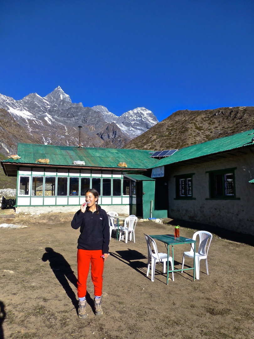
::another epic toothbrushing view::
::Dzongla::
Also, I admire Jenni for pushing herself and overcoming fear and sickness. It can be difficult to know when one’s altitude symptoms require descent vs. just tolerating pain and discomfort. Perhaps even harder only a month after being hospitalized following uncertainty about her ailments at the time. Jenni fought through like a champ and this allowed us to finish the trek with great success.
::heading out of Dzongla::
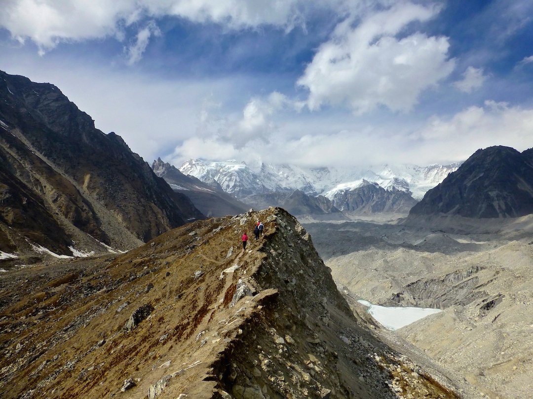
On the walk out from Dzongla, to Lobuche (where we joined back up with the main EBC trail), we peeped some climbers on their way to summiting Lobuche East. Incredible. Check out the zoomed in shot, and then for some perspective on the feat they accomplished, look at the next zoomed out shot of the mountain they are on.
::climbers::
::that’s the mountain they are climbing!::
We, on the other hand, were very thankful to have a much easier day post-Cho La. A quick couple hours leisurely walk brought us back to the EBC trail (and way more people!).
Practical Info
We did our loop hike by first going up the Gokyo Valley and then crossing the Cho La Pass from west to east. Some do it in the opposite direction. As noted above, we were happy to ascend the steeper and more challenging side of the pass and descend the comparatively easier side. The views on the descent were awesome, too, with Ama Dablam directly ahead of us.
You could leave from Gokyo and cross the pass in the same day, but it would be pretty hard. Crossing the glacier from Gokyo to Thangnag is not so easy, and you want to cross the pass early in the day to increase the likelihood of favorable conditions. However, if you are looking to save time, you could definitely make it all the way to Lobuche on the same day as crossing the pass. We were not in a rush and with Jenni’s altitude sickness we were happy to settle in Dzongla, but you could hike another 2-3 hours and get to Lobuche well before dark.
Accommodation: In Dzongla we stayed at the Hotel Zongla Inn. The location was breathtaking, with Cholatse towering above us.
The trail became steeper and narrower after we split from the main EBC route and headed up the Gokyo Valley. We were rewarded with a far less crowded area and some truly stunning vistas.
::at the junction where we turned towards Gokyo::
::mountain laundry::
::Gokyo Valley::
We glimpsed our first Himalayan tahrs (like wild mountain goats) with hair that Fabio would envy, as well as these beautiful birds that we swear our guide called Mountain Patricks, but Google knows of no such thing. Maybe they were partridges? Whatever their name, we began seeing and hearing them a lot. Especially as we huffed and puffed up the side mountains and high pass, these birds would always be squawking and we detected a hint of laughter.
::mountain patrick?::
::call of the mountain goat::
::tahr on the trail::
::checking us out::
While we’d planned to trek a bit further before stopping for lunch, the views from Mong La, a small village en route to our first night at Dhole, were too good to pass up. The weather was still warm enough for us to sit outside and so we enjoyed a tasty meal here with this phenomenal view.
::Mong La::
::lunch spot in Mong La::
The trails and trekking days became somewhat more difficult here, as the ups and downs increased. For example, I think our first day out of Namche had us starting at 3440m, ascending to 3980m where we lunched, descending to 3680m and then rising again to 4110m.
::more mountain patricks::
It was also here that the creature comforts began disappearing: no more free battery charging (only for a fee, and only when there is power, which often is generated from just a few solar panels), no more rooms with private toilets, and in general, say goodbye to western toilets. Hello holes in the ground and getting out of your warm sleeping bag and into your freezing cold boots to pee at night! At most tea houses there is no heat source except for a stove (yak pie fueled!) in the common room which is usually turned on around five at night and stoked through dinner. This common room is where we tend to spend most of our non-trekking waking hours as it’s warmed by the body heat and/or the fire. The rooms are far from the stove and have plywood thin walls (freezing. literally. your water, contact lenses and toothpaste all freeze overnight). Also, the common room is where we do the only three things we do aside from trekking: eat, drink tea and play cards. Rishi taught us how to play dhumbal, which is a Nepali game that’s easy to learn and a great way to pass the time. Lots of rounds were played over the next week and a half, lots.
::keeping warm by the stove::
::some spectacular teeth brushing spots on this trek::
::brr::
::playing cards::
::tea house, yak::
Leaving Dhole the views up-valley became more expansive: Cho Oyu straight ahead, Cholatse and Taboche off to the right and Thamserku and Kangtega behind and to the right. A relatively easy day of hiking took us to our next destination of Machhermo (4470m). But there is acclimatization to be done, so the day wasn’t quite as easy after an afternoon hike up the ridge behind town where the winds were gusting and again we saw Everest beyond Cholatse plus great views of Cho Oyu.
Having been delayed a day due to weather canceling our scheduled flight into Lukla, we had to find a way to make up a day. We decided to wake early the next morning, get to Gokyo quickly and try to see as much as possible that day so we could skip our “rest” day there. Wikipedia says the Gokyo Lakes “are the world’s highest freshwater lake system comprising six main lakes.” We passed “first lake” on our hike and it was thawed though tiny. Second lake was mainly frozen, as was third lake (i.e. the Gokyo Lake), which is where the town of Gokyo sits. Bummer because the pictures we’ve seen of the turquoise lake look gorgeous.
::first lake::
::stunning views and porters working hard::
Thus we decided to skip the optional hike up to fourth lake (it was higher and certainly frozen) that afternoon and instead we did a quick hike up to the ridge behind town from where we had great views of Gokyo Lake, the tiny hamlet of Gokyo and Gokyo Ri (to be hiked the next morning) to one side, and the Ngozumpa glacier (to be crossed after hiking Gokyo Ri) to the other.
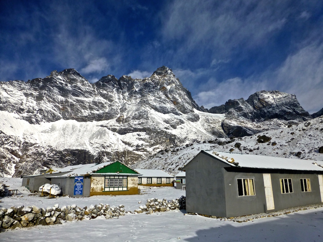
Our tea house at Gokyo was another one of our favorites. It had lovely views, a warmish common area, and one of the toilets was western (although no western flushing mechanism, don’t get too excited now).
::view from our teahouse::
By now it’s getting colder but it’s still bearable. Neither of us wore multiple layers on the bottom until Gokyo. After that Jenni rolled three pants til Namche.
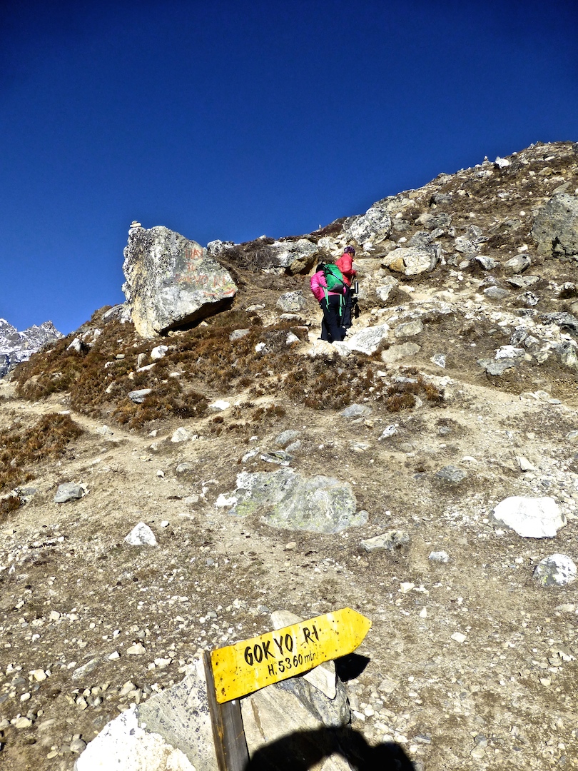
Our first of the “big four” destinations was Gokyo Ri. I call them the big four because they are the highest points on our trek, generally the most difficult to climb, and sort of the highlights of these treks. The big four are: (i) Gokyo Ri – a 5357m peak abutting Gokyo town and lake and which affords mind-blowing views of Everest and everything else; (ii) crossing Cho La Pass – maybe not so much a destination as a necessary evil to take you from Gokyo back to the EBC route; (iii) Everest Base Camp – self-explanatory; and (iv) Kala Patthar – the mountain near EBC and the highest point (5545m) on our trek. It’s clear that the altitude started getting to Jenni as she requested the “Call of the Mountain Goats” song as climbing inspiration (it’s In The Hall of the Mountain King).
::beginning of Gokyo Ri::
::halfway up, looking down on the town of Gokyo::
::looking out at Gokyo Ri from the ridge::
It took us just about two hours to summit Gokyo Ri (and about an hour down). Damn these mountains for looking so easy next to the mammoth peaks around them, because it is not a walk in the park. The climb alone is not terribly difficult. It’s an ascent of a bit more than 1800 feet, which would normally be a pretty breezy hike, were it not for the fact that you’re going from ~15.7k feet to ~17.6k feet above sea level. You don’t realize how much you appreciate oxygen until you trek at these heights! Jenni was definitely feeling the altitude at this point, and to top it off she somehow managed to ram her head into a rock a few feet from the top. Needless to say she wasn’t the happiest camper up there. (Alan had in his notes: “She didn’t even take chocolate from Andrew at the top!!” So. You know it was serious).
::mountains, glacier, Gokyo and the lake::
::mountains, glacier, Gokyo and the lake::
::alan and everest::
Check out these views of Everest, Makalu, Lhotse, Cho Oyu, Renjo La pass etc… from the summit.
::alan and everest::
After relaxing over lunch, we crossed the Ngozumpa glacier to get to Thangnag. At about 22 miles, I think it is the longest glacier in Nepal. While the glacier doesn’t look wide (you can see the town of Thangnag from the ridge just behind Gokyo), it’s not so easy to traverse, made difficult by the up and down plus loose rock and snow. The surreal landscape felt lunar. Two hours scrambling across the moon later and we made it to Thangnag where we were literally the only guests in our teahouse. We watched the snowfall as we (what else) enjoyed tea, cookies and several rounds of dhumbal. It was an early night to bed so we could rise early and face the beast: Cho La Pass. (P.S. a “late” night while trekking is 8pm, so…).
::descending into the glacier::
::that’s all ice, ice, baby::
Practical Info
Accommodation: In Dhole we stayed at Alpine Cottage Lodge. I think we saw a sign that a room costs 200, or 1000 if you do not take meals there. In Macchermo we stayed at Trekkers Lodge. In Gokyo we stayed at Gokyo Resort, one of our favorites. Our room #17 overlooked the lake and mountains. Here we charged batteries for 300/hour and the WiFi worked pretty well and cost 500/day. In Thangnag we stayed at Thangnag Guest House.
Food and Drinks: Lunch on the way to Dhole in Mong La was on the patio at Bouddha Lodge, next to Hill Top Guesthouse and near the Viewpoint Guesthouse. We thought the food at Gokyo Resort was some of the best. They actually seasoned dishes the way we might at home (much of the food served while trekking is uber-bland, requiring boatloads of assistance from the salt and pepper shakers).
Activities: We did not attend, but we saw signs for the free altitude talk daily at 3 pm in Macchermo. I think this is run by the International Porter Protection Group, whose website is http://www.ippg.net.
The big day had finally arrived, we were scheduled to fly from Kathmandu to Lukla to begin our Himalayan trek! And Jenni was nervous (isn’t she always?). The suspense was killing us as we waited at the domestic terminal of the Kathmandu airport for nearly six hours, only to be sent home around 2 pm when they called off all flights for the rest of the day. (Flights to Lukla are often cancelled due to wind). This has got to be one of the craziest airports I’ve ever been to: hectic as can be, there does not appear to be any usage of lines, but people gather in large groups around the piles of expedition gear, waiting for their turn to check in, and there are even monkeys crawling round outside. Emotionally drained, we headed to a hotel in Thamel for the evening to try again in the morning.
::a wee bit nervous::
::Kathmandu domestic airport – expedition gear::
Friday morning brought us success and we finally boarded the dinkiest of planes (I’m still nearly certain this thing is a toy, not a commercial vehicle) for an exciting journey to Lukla.
::toy plane::
::dinky plane::
We grabbed seats on the left to enjoy the view of the mountains coming in. The views were pretty spectacular, if not a bit fear inducing. Luckily, a Swiss veteran of the Himalayas was seated next to Jenni and coached her through the ride. The landing is by far the most nerve-wracking part, approaching a runway that is maybe 500 meters long and uphill so the plane can stop in time.
::world’s tiniest landing strip!::
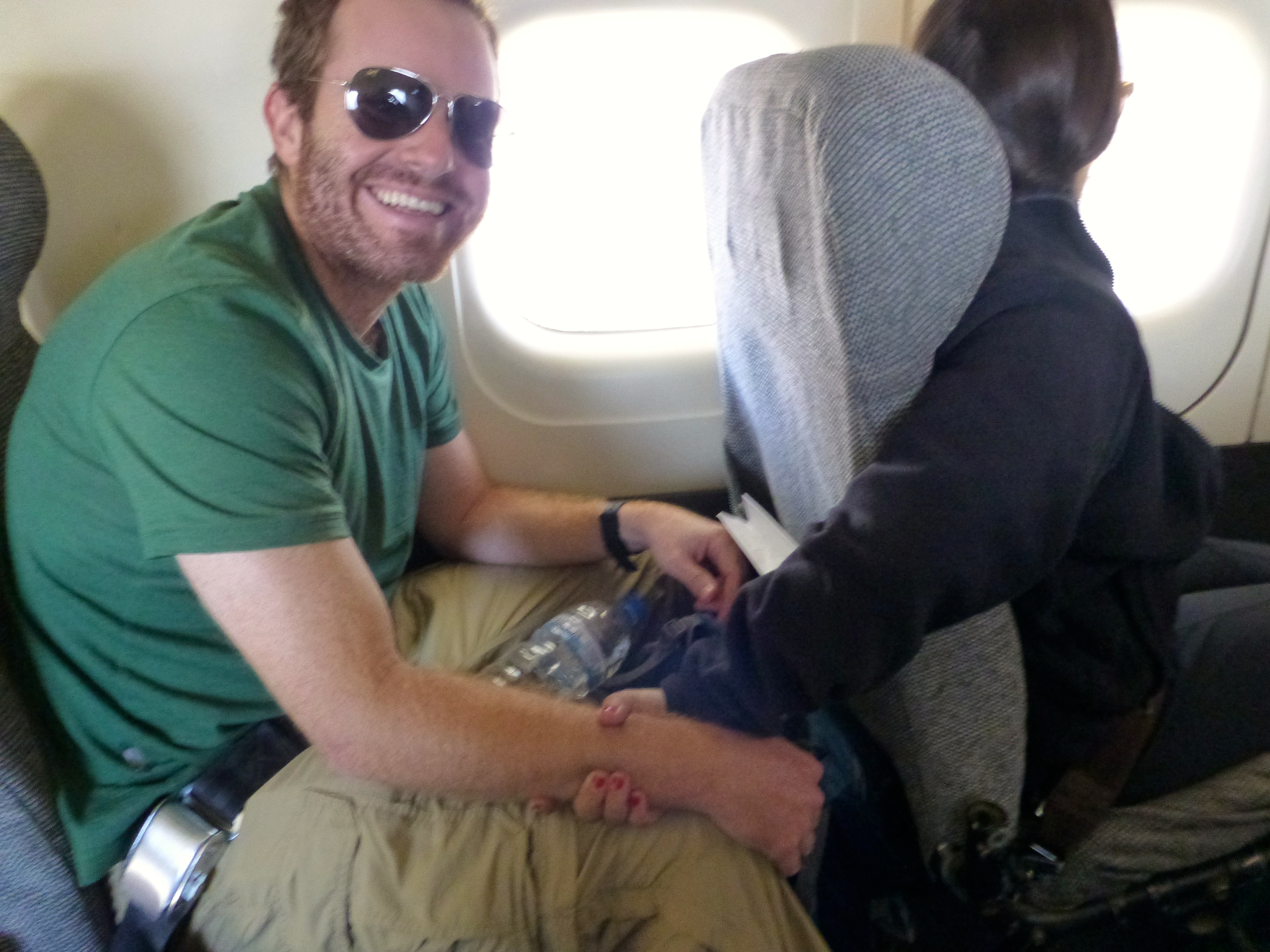
Apologies for the lack of photos. Jenni had Alan’s hand in a deadlock grip. Proof:
::she was freaking just a little bit::
Upon arriving in Lukla we met our porter, Sange, who quickly earned our respect, hauling our duffel bags up and down the mountains with incredible speed and agility. Like all porters, he carries his cargo using a strap that goes over his head. And we learned that unlike say the Inca trail, there is no government regulation of how much porters can carry. So those willing to earn more in exchange for more bodily abuse might carry as much as 80-100kg!!
After our first of what proved to be innumerable cups of tea, we set out on our trek. In other words, we jam jam-ed. (Jam jam is Nepali for “let’s go.” Lots of jam jamming happened from here on out). The hike to Phakding was a leisurely walk over a mostly stone trail. We got our first views of some awe-inspiring mountains, though these were only ~6000m. To put that in perspective, most of these Himalayan dwarves would be the tallest mountains on every other continent except South America (Denali in Alaska is just under 6200m but many of these non-famous Himalayan peaks are higher). We had yet to peep the truly awesome 8000m peaks to come. We were also introduced to dzopkyos, a hybrid of cattle and yak, used to transport goods up and down the mountains (at and above Namche you mainly see yaks, but it’s too warm for the furry yaks down at this altitude). We learned right away that it’s not always easy to pass a dzopkyo (or yak) train and the traffic jams can be brutal.
::dzopkyo jam::
Already we began passing Tibetan prayer flags and wheels, learning from Rishi (our guide) that we always had to pass to the left of the manis (i.e. clockwise, with manis to our right). We also observed that many locals have red cheeks from the cold weather.
We spent our first night in the happening (I kid you not) Himalayan town of Phakding. We checked out the Sherpa Liquid’s bar pool hall, bumping with some Guns N Roses, never mind that we (and our fellow Himalayan Glacier trekkers) were the only guests. (On this portion of the trek we were together with Michiel, Regina, Jarrod and Jenna from another Himalayan Glacier group, and their guide Dole. We parted ways with this group when we headed up the Gokyo Valley. Andrew and his guide, Shankar, were with us through EBC and Kala Patthar, and we parted ways when we continued down to Pheriche and Andrew went to climb Island Peak.) There was also a reggae bar and plenty of other bakeries, teahouses and restaurants.
::pool hall a la Phakding::
::our room in Phakding::
Jenni was beyond pleased by the presence of dogs at this elevation. She definitely considered sticking one in her bag. Who are we kidding, in the porter’s bag.
::himalayan kids and pups::
The land is quite fertile at this elevation, and we passed several steep terraced hillsides, planted with potato, cabbage, bok choy and tomato (who would have thought we’d be eating fresher and more local up here than back home?). We walked along the Dudh Kosi River, which drains the Mount Everest massif, crossing our first of many suspension bridges. While generally well constructed, some of these bridges are a little scary for one with a fear of heights.
The walk from Phakding to Namche Bazaar was our first “real” trekking day, taking around six hours including a stop for lunch. We crossed a few checkpoints where we entered Sagarmatha National Park. While waiting for the guides to pass through the checkpoint we played with a few local kids. They succeeded in toppling Alan over and in the process his boot crushed the poor kid’s hand. A few tears later and the two of them were playing patty cake. Tough little nuggets, those Himalayan raised kids are.
::cute little kiddos::
::checkpoint::
::entering the park::
The scariest bridge EVER was crossed: the Hillary Bridge. Newly built to replace the aging bridge Edmund Hillary sponsored long ago, which itself was up high, this one soars above at something like 200m high. Jenni was able to chant “it’s just a walkway” to herself and race across it without turning to a panicky mess. This is not to say that she was calm in doing so.
::see that bridge WAY up there? yeah, we crossed that::
::pictures do NOT capture how high this thing is!!::
::fear::
This day proved to be one of the worst weather-wise on our whole trek (luckily) and so we missed the chance to spot Everest from the first viewpoint.
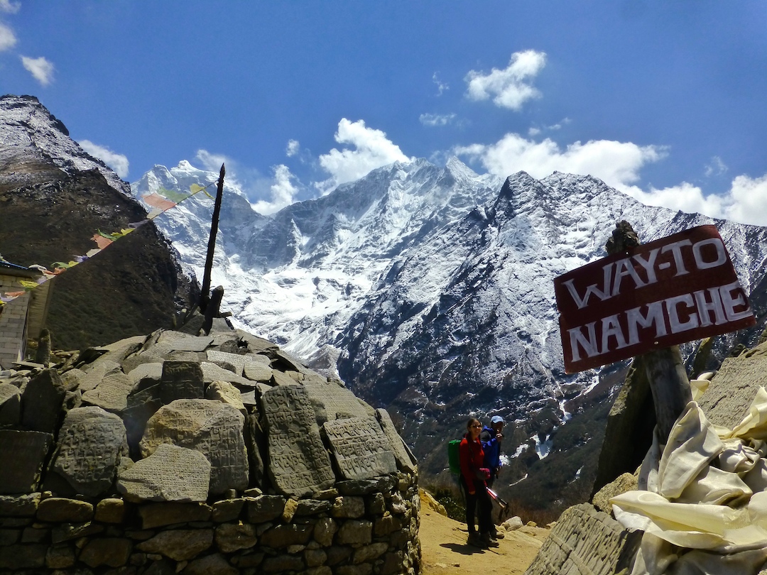
After a few hours of steeper climbing past the bridge we arrived at the booming mountain metropolis of Namche Bazaar. Kidding aside, this hilltop village is impressively large. It’s nestled in a steep hillside shaped like an amphitheater, lined with stone staircases and countless tea houses trimmed in blue, green and red. Above and within are terraced farm plots.
::alan and Namche::
::stairs through Namche::
::entering Namche::
We settled into what turned out to be one of our favorite teahouses, enjoying our 5 o’clock tea and cookies (a trekking ritual we already deeply miss) before a day we thought would be restful.
::chilling in the tea house::
::mani right outside our tea house::
::looking down on Namche::
The “rest” day started out promising: the sun was shining, we climbed briefly up to the museum where we caught our first glimpse ever of the world’s tallest mountain (cue Jenni gleefully exclaiming “I’ve seen Everest! We can go home now!”), as well as other big and beautiful peaks like Lhotse and Ama Dablam. From there a few from our group made the smart decision to actually rest, while the remainder of us headed up for further acclimatization.
::Everest! our first sighting::
::horse and Everest::
::Everest!::
We viewed the old Syangboche airport (i.e. dirt strip), which is the closest landing strip to EBC but is rarely used. From there we continued ascending as the weather continued to decline. Through rolling fog we made our way up to the Hotel Everest View and got some sneak peaks of the spectacular vista when the clouds parted. Feeling the first effects of the altitude the mood declined for many of us. We did, however, eat lunch in Khumjung where we also saw our first yak, a “yeti” skull (recommend skipping this), and the Hillary school.
::amadablam::
::first yak sighting::
::Hillary school::
::Hillary school::
::acclimatizing::
::down to khumjung::
::Hillary school::
Back in town we had our last shower for over a week, something Alan enjoyed and Jenni regretted as soon as she realized her hair would freeze while she waited for it to dry. Also because those shampoo sheets are the worst invention known to man. (They do not lather, and they do not wash out. I had clumps in my hair for the next week.)
The next day we had about an hour and a half of trekking left with the half of our group going directly to EBC. The trail was lovely here, with fantastic views of Everest. We passed the Tenzing Norgay Memorial Stupa and saw some huge birds that I think were vultures. As the trail split we said goodbye to the others and turned left towards Gokyo Valley, leaving behind warmth and crowds.
::Everest::
Practical Info
Himalayan Glacier made all arrangements for us, but you could pick up guides and porters in Lukla or Namche Bazaar, I think. You can also find plenty of accommodation and some gear in these towns. We visited a store in Namche selling books, booze, SD cards, batteries, etc. It is a good idea to stock up on what you might need in Namche, as availability drops dramatically (and prices rise with the elevation)…especially if you’re heading up the Gokyo Valley and off the main EBC trail. Phakding is smaller than Lukla or Namche but still has several tea houses and some bakeries and bars.
Transportation: We took a Yeti Air flight from Kathmandu to Lukla. Try to sit on the left (when facing forward) of the plane for great mountain views. It is pretty neat to get off a plane and just start walking. Though it is far less common, you can begin your trek in Jiri and after several days join the trail between Lukla and Phakding.
Accommodation: In Phakding we stayed at Snowland Lodge. Our room had two twin beds and a private toilet, though there was a large square cut out of the wall connecting our bathroom to our neighbors. This was weird, and gave us flashbacks to our NYE experience in Agra, India. I think there were outlets in the room.
In Namche we stayed at The Nest and our room was much larger with a double bed and a nicer bathroom with hot water shower. We could walk out onto an unfinished balcony type space (I think rooms 210&211 have this feature). At The Nest there were outlets in our room and the WiFi for 500/day worked fairly well. There are several accommodation options in the villages at these low elevations, especially in Namche. Including the Hotel Hill-Ten.
Food and Drinks: All our meals were included in our tour arrangements, but generally breakfast costs 200-400 and lunch and dinner more like 300-700. Bottled water is readily available from Lukla to Namche for 80-120/liter. Beyond here, we used purification methods as water becomes more expensive and it is harder to recycle/dispose of waste.
We did the Everest Base Camp (“EBC”) via Gokyo Lakes trek with Himalayan Glacier. The mountain scenery was spectacular! Because we opted for an all-inclusive package, we have only limited info/knowledge regarding matters like air tickets to/from Lukla, hiring guides and porters, arranging permits, selecting accommodation, etc. We will talk about what trek we did and why, and we will share any insights gained. This post will be an overview and is heavy on the practical info. We will cover the segments in other posts with lots more photos.
Note that many of the village and other names have multiple spellings, and it is difficult to find exact stats for elevations and distances. We will generally use “feet” instead of “meters,” and keep in mind that the difference between starting and ending elevation may be a very rough approximation of total vertical gained or lost as some of the trails have big ups and downs.
Our Route
We flew from Kathmandu to Lukla on Friday April 4. We were scheduled to fly on April 3 but after waiting several hours at the airport we were told to go home. Flights in and out of Lukla are frequently canceled due to weather/wind.
April 4: After landing in Lukla (9,315’) we hiked to Phakding (8,560’).
April 5: Hike to Namche Bazaar (11,300’).
April 6: Acclimatization day in Namche Bazaar. This became a notorious day as many believed it was a “rest” day, but actually it was a full day of trekking.
April 7: Hike to Dhole (13,480’). This is the day we split from the main EBC trail to head up the Gokyo Valley.
April 8: Hike to Macchermo (14,660’).
April 9: Hike to Gokyo (15,740’).
April 10: Hike up and down Gokyo Ri (17,575’) then to Thangnag (15,420’). Note that we skipped a “rest”day in Gokyo on account of missing our April 3 flight.
April 11: Cross the Cho La Pass (17,610’) to Dzongla (15,840’).
April 12: Hike to Lobuche (16,170’). This is where we rejoined the main EBC trail.
April 13: Hike to Gorak Shep (16,920’) then EBC (17,600’) and back to Gorak Shep.
April 14: Hike up Kala Patthar (18,200’) then down to Pheriche (14,000’).
April 15: Hike to Namche Bazaar (11,300’).
April 16: Helicopter from Namche Bazaar to Kathmandu. We planned to hike back to Lukla and fly out the next day, but someone on another trek with the same operator was sick and hired a helicopter so we got a free lift.
Why We Chose This Trek
We were deciding between this trek or the Annapurna Circuit, i.e. the two most famous. We did limited research and by no means are we expert on the Nepal trekking options. We had read there is now road access for part of the Annapurna Circuit, and that put us off a bit. We pretty much chose the EBC area for its concentration of jaw-dropping gigantic mountains.
I believe the Annapurna Circuit covers a more diverse range of climates and elevations. Pokhara is the gateway to Annapurna, and we are told it is a beautiful place and certainly flights to Pokhara are much less susceptible to weather issues.
My father had done the EBC trek (with a little side excursion to Chukkhung) a few years ago and loved it (aside from the cold and general lack of comfort). Once we settled on the EBC area, we still had several options. We considered the Three Passes route but decided that was a little too ambitious. I have hiked some 14’ers in the US and crossed a 16k foot pass in Peru, but Jenni had never been higher than 11k feet (i.e. the top of a US ski mountain). So not knowing how she’d respond to the altitude we didn’t want to commit to three passes, but we also wanted to get somewhat off the beaten path and enjoy more of the scenery. And while crossing Cho La Pass was by far the most difficult day, we were very pleased with the trek we chose and would highly recommend the Gokyo Lakes route to those up for the challenge.
By trekking up the Gokyo Valley, we escaped some of the crowds on the main EBC trail for a while. We enjoyed outstanding scenery and smaller tea houses. We saw a few Himalayan tahrs (relatives of wild mountain goats), which we did not see on the main EBC trail. And, as a huge plus, the overwhelming majority of our trek was a loop rather than out and back.
We met a Swiss group and one among them visits Nepal often. I asked his favorite trek and he said probably the Dhaulagiri Circuit. It is near Annapurna and I believe quite difficult. There are many different regions to trek in Nepal and some are more remote. Our goal was to see a lot of the really big mountains from really close, and that is why we chose EBC.
When To Go
The true peak season for EBC is around October-November. The air is clearest after the summer rains. The second peak is when we went, around mid-March to mid-May. I think very few trek during the summer monsoon months (think rain, mud and leeches), and you can trek through the winter but it may be very cold and some passes may be dangerous.
It seems that our April trek offered some advantages and some disadvantages. It was not as crowded as the fall, we generally had very good weather, and I imagine there is more snow around. The rhododendrons were in bloom, which was nice, though I think these may be more impressive on the Annapurna Circuit. We also saw many people on their way to climbing Everest, and the tents were all set up at EBC. I don’t think there are any tents at EBC in the fall and nobody climbs the mountain that time of year.
That said, all the lakes were frozen. So if you Google “Gokyo Lakes” and see brilliant turquoise water, you may be disappointed to see only snow and ice on arrival. I think the landscape in general would be more green in the fall, and surely the rivers would rage much more impressively. The air in Kathmandu was very hazy for us, and I think it (and views on the flights) is clearer in the fall.
Tour Operator
We chose Himalayan Glacier. I had come across the company in a NY Times article. Overall, we were very pleased and happy to recommend this company to others. Our guide, Rishi, was great.
There are countless operators, both based abroad and in Nepal. When selecting an operator, you might consider things like how long they’ve been doing this, how they treat their guides and porters, what is included vs. extra, etc. One of the selling points for us was Himalayan Glacier’s willingness to ensure a private trip for the two of us. Although we spent most of our time together with other tourists and guides from the same company, Jenni and I had our own guide and we had the flexibility to adjust our speed or plans if necessary.
Independent vs. Guided
We saw plenty of people trekking without a guide and carrying their own large packs. I’m sure you can save money this way and can imagine one might have an even greater sense of accomplishment. Especially if you are sticking to the main EBC trail, it would be fairly easy to find your way. When you add the high pass and glacier crossing, it would be a little harder to navigate on your own, though certainly doable. That said, we never considered going independent and probably never would.
A day pack alone weighs a fair amount if you are properly prepared and carry a lot of water. Having a porter carry the rest of your belongings makes the trek more enjoyable and helps support the local economy. Our guide was extremely attentive and answered questions about the Himalayan way of life, which mountains we were viewing, etc. We never had to decide where to stay or how far to push each day. And we learned a fun card game called dhumbal.
Accommodation
There are ample tea houses covering the entire route. At lower elevations, the villages tend to be larger and have a more permanent population. At higher elevations, the villages are smaller and may have no year-round residents. Rather the tea houses are owned and/or operated seasonally by people who live down the mountain or even in Kathmandu.
Everywhere we stayed was basic, but there were some significant variations in comfort level. We always had a private bedroom. In Phakding and Namche Bazaar we had a private bathroom, and the latter even had a hot water shower. Everywhere else, the toilets were shared and generally consisted of a porcelain hole in the ground. Some places had western style toilets but with no seat and no flushing mechanism (aside from a jug of water to pour). We descended quickly on the EBC main trail and thus did not sample as many villages there, but I think you may retain some amenities beyond Namche Bazaar (e.g. in Tengboche and Pangboche etc.) vs. what we found in the Gokyo Valley.
There are some places that are more expensive and said to be more luxurious. These include the Hotel Everest View (we stopped here on our acclimatization day above Namche Bazaar and the views are wonderful) and some Yeti Mountain Home properties. What exactly these provide I don’t know, but I’m not sure the value for your money would be there (e.g. some of the tea houses we stayed in cost the equivalent of $2 a night, versus $200 I’m told for some of these “luxury” places, but I don’t think they are luxury in the typical, non-Himalayan sense).
Food
Although dal bhat (literally lentils and rice) is legendary in these parts and perhaps once was the only option available to trekkers, you will have many other options at the tea houses. Breakfast choices usually include eggs, toast, porridge, pancakes, Tibetan bread (i.e. fried dough, yummy), etc. Lunch and dinner choices include fried noodles, fried rice, chicken or buffalo dishes, soups, popcorn, french fries, etc. Cheese may be limited to nak (female yak) cheese, which we found OK but some dislike it. It’s a bit pungent. Coffee is available and tea (in many flavors) is ubiquitous.
Our guide advised us that it is wise to avoid meat and milk above Namche Bazaar. Apparently they do not slaughter animals in the mountains and there is minimal freezing/refrigeration (aside from the cold temperatures, but it can be sunny and warmer during the day), so if you order meat up high then it may be many days old. That said, we saw some pretty experienced folks eating spaghetti bolognese in Lobuche. We also had fellow trekkers suffer stomach illness as early as Namche.
It is a good idea to bring along snacks, although we were well-fed and rarely needed these. Salt is your friend when sweating a lot. Nuts, granola bars, Snickers, etc.
How We Trained
We did not. I went back and forth between telling myself I trained not at all or that I’ve been training for the last eight years. We have been traveling for months and that entails moving around a lot, so it is not as though we stood up from our desks and embarked on the trek. Had we come from home, I am sure we would have been exercising a lot and hiking locally and probably doing sets on the Santa Monica stairs. Instead, after Jenni got sick in Borneo we scrapped some hikes we had planned there and in the Philippines.
The best advice I can give is to assess yourself honestly. If you are reasonably active and fit, I do not think you need to train at all. You cannot really prepare for the altitude, and that is the biggest wildcard. We felt that training would not have made much difference for us, except that our legs probably would not have been sore at all vs. being sore on a couple of the days.
The most important thing is having comfortable footwear that you can walk in for several miles day after day. And good balance is helpful. There is often awkward footing and some rock-hopping, some of it across water or ice and much of it on wobblers, and good balance will reduce your chance of injury.
Packing List
Because we had been traveling around the tropics before arriving in Nepal, we brought less than we would have if coming straight from home. I think this was a blessing. This will be a detailed list of what each of us brought.
Buying Supplies Locally: The main tourist area of Thamel in Kathmandu is loaded with shops selling trekking and mountaineering gear. Most of it is fake and most shops do not pretend otherwise. There seem to be some shops selling legitimate gear that is priced as you would find it in the US, if not more expensive. Generally speaking, it is easy and cheap to buy fake fleece, down, hats, trekking poles, pack covers, etc. We bought a handful of genuine fakes and what seemed to be a real Camel-Bak reservoir and socks, since we did not want liquid leaking all over our things and good socks are critical. Note that the advertised sizes on the fake backpacks we saw were grossly inflated, i.e. if you actually want a 30L backpack you should probably buy one that says it’s 50L.
Himalayan Glacier loaned us (included in the trek price) sleeping bags and big puffy down jackets.
Bags: Himalayan Glacier provided us with waterproof duffel bags that the porters carried, and it was delightful to have so much extra space in these bags such that packing each day on the trek was the easiest it has been our whole trip. I used the 35L Gregory daypack I’ve had for years, and Jenni used the 18L REI lightweight pack we bought for the broader trip. This was quite small and meant she could not fit many layers in it, nor carry much water. So Alan wound up carrying the water for both of us and Jenni supplemented the small backpack with a fanny pack. That’s right, she’ll be rocking the fanny pack in some or all of the photos. For your viewing pleasure folks. (P.S. Don’t knock it til you try it. That thing comes in handy in the Himalayas!).
Shared Miscellaneous Items:
Water purification (Aqua Mira drops plus Katadyn Micropur tablets, note the amount of time required to purify)
Water bottles (local and cheap) and Camel-Bak 3L reservoir
Flavor powder for purified water (local and cheap, we bought 2 packs and had plenty extra)
Extra zip-loc bags
Ear plugs!!! (The tea house walls are like paper, you can literally hear your neighbor breathing, so unless you are the world’s deepest sleeper, you will want these basically every night)
Compass
Leatherman knife
Emergency whistle
Headlamps with extra batteries
Pad locks for duffel (local, ~$2)
Snacks (Snickers, chocolate, granola bars, etc.)
Neck Pillow (the kind you bring on airplanes. Jenni brought this not knowing if there’d be pillows at the tea houses, and there always were so she actually never used it. Sorry Sange!)
Technology/Entertainment:
Camera with extra memory card plus cleaning pen and mini-tripod
We each brought a Kindle (+ charger) and iPhone (+ charger). It was so cold and I didn’t want to bother paying to charge it so I barely ended up using my Kindle, but Alan used his fairly often. If coming from home I’d probably have brought real, paper books. Charging is available at most teahouses for an hourly fee, but it’s not super consistent because much of the power as you reach higher elevations is solar and you can’t always count on the sun shining.
Cards (I bought a pack of cards on the way up, and they got very good mileage in the couple weeks we were up there. Pick your own means of entertainment, but cards are an excellent way to pass the time in the cold tea houses. I saw a few other groups with Uno sets and I have to admit, I was pretty jealous).
Toiletries:
Toothbrush
Toothpaste
Floss
Contact lenses with spares
Lens solution
Glasses
Sunglasses
Deodorant
Baby powder
Soap (Sea to Summit Wilderness Wash)
Hand sanitizer
Tissues (those little packs are great for carrying as you trek) and lots of toilet paper (not provided anywhere on the mountain!)
Sun block (for what little of your skin is actually exposed)
Chapstick with SPF
Hair ties and headbands
Quick-dry lightweight towels (local, ~$5)
Baby wipes (I’d read these come in really handy since you aren’t showering, but honestly it was so cold we didn’t even really use these. You just come to terms with your trekking filth)
Pee-tool (I think I was still too embarrassed to even admit owning this when I initially posted a packing list, but well…if a blog is not for over-sharing, then what is it for, eh? I bought a pee tool off Amazon because I used to not know how to pee standing up. There, I said it. This is basically an ergonomically designed funnel that allows me to pee like a man. Without removing my pants. It’s come in immensely helpful on various hiking and backpacking trips. It also was extremely clutch in India on a long drive with no toilet access. But I am very proud to say that over the course of four months in Southeast Asia, I learned how to squat pee. Anyone who knew me in college and ever attended an outdoor function with limited toilets has probably seen me hide between cars as my pants are fully removed and thrown over the top of one. Well, I’m a big girl now. And I trekked for two weeks in the Himalayas without using my pee tool. Go me.)
Medical:
Diamox (altitude medication). We started taking this as early as Namche. A lot of people held out until later, but most people we met used it at least for some portion of their trek. I think it definitely helps. Jenni wound up feeling (mostly minor) effects from the altitude every day from Namche until she was back to Namche (that’s nine days of headaches, in case anyone was counting).
Other more customary medication like birth control, Advil, Immodium, etc.
Moleskin, bandaids, athletic tape
Alan’s Clothing:
Boxer briefs (5 pair)
Hiking socks (3 pair) and liners (1 pair)
Hiking shoes. I hiked in Garmont gore-tex shoes that are sturdy but low-cut. I have done most big hikes in shoes rather than boots, and these worked fine on the trek. If you are carrying your own pack, you would more likely care about proper hiking boots. And my feet were a little cold at times, but I would probably wear the same shoes again.
Tops: mid-weight SmartWool zip-neck long underwear top (1); quick-dry shirts (2 short sleeve and 1 long sleeve); Patagonia fleece top (1); Arc’Teryx Atom LT Hoody (1); rain jacket; lightweight fleece top (local, ~$10 with bottom, and used for evenings); loaner down jacket used for early morning starts and some cold evenings
Bottoms: lightweight long underwear bottoms (1 pair); zip-off trekking pants (1 pair); rain pants; lightweight fleece bottom (local, ~$10 with top, and used for evenings); heavy REI fleece pants
Accessories: balaclava; winter hat (actually had 1 for day and 1 for night); undergloves; down mittens (bought locally for ~$5); down booties (local, ~$5); collapsible trekking poles; bandana (mainly as Kindle cover); day pack rain cover (local, ~$2)
Jenni’s Clothing:
Underwear (let’s start off getting real, shall we? I packed probably 14 pairs. I used 3. It’s far too cold to remove your pants up there. Don’t judge me til you’ve trekked at this altitude!)
Panty liners (so, if you’re not changing your undies, changing a panty liner each day is the next best thing)
Bras: 2 sports bras, 1 sleeping bra (I used this at lower elevations but again you stop changing as it gets higher and colder)
Hiking socks (3 pairs) and liners (1 pair)
Hiking boots!
Tops: quick dry short-sleeve t-shirts (2 but 1 would have probably sufficed); quick dry long-sleeve shirt (1); cotton/polyester long-sleeve hooded shirt (this came in so clutch because I used it to cover my face and head when it was cold but not bad enough to pull out the balaclava. I wore it almost every day as my second layer, over a short or long sleeve quick dry top); double thick fleece jacket (bought locally for ~$9); Patagonia down jacket; big puffy down jacket loaned by Himalayan Glacier (used this when we left before the sun was up, to start Cho La Pass and Kala Patthar, otherwise got limited use out of it)
Bottoms: running pants (used as my base layer every day after Gokyo); hiking pants (these were great on their own up until Gokyo, then I supplemented them with the running pants and fleece pants underneath and didn’t take off any of those three layers for the next week)
Long Underwear: lightweight fleece top and bottom (local, ~$10, generally used the top for evenings and as an extra layer when it was really cold. I used the fleece as part of my pants trifecta); second pair of fleece pants (used for sleeping and packed in my day pack for really cold days to fit over my other 3 pairs of pants and under my rain pants – only used once for that purpose)
Wet weather gear: rain pants and rain jacket (kept these in my daypack every day and used when it snowed); poncho (used one day when it snowed really hard, worked fabulously as a pack cover if not the least stylish outfit of all times)
Accessories: undergloves; down mittens (bought locally for ~$5); balaclava, winter hat; down booties (local, ~$5)
::be prepared to look this sexy::
Other items we wished we had: Jenni would have killed for some clean clothes after her shower in Namche (the only things that weren’t dirty by that point were those millions of untouched pairs of undies). She also regretted her decision to forego the hairbrush. Had Alan come straight from home, he would have brought his gore-tex shell jacket and perhaps pants (both of which I ski in), probably gaiters, heavier leather hiking boots and heavier socks. I managed fine without any of this. Flip-flops or Crocs would be nice for using toilets while not trekking. We could not wear our down booties on the wet surfaces and putting on your hiking shoes/boots isn’t ideal, but it’s not so bad. And we saw others using those Starbucks Via instant coffee packets, which might be a nice touch if you’re pickier about your morning coffee.